Last updated on July 3rd, 2026 at 05:37 pm
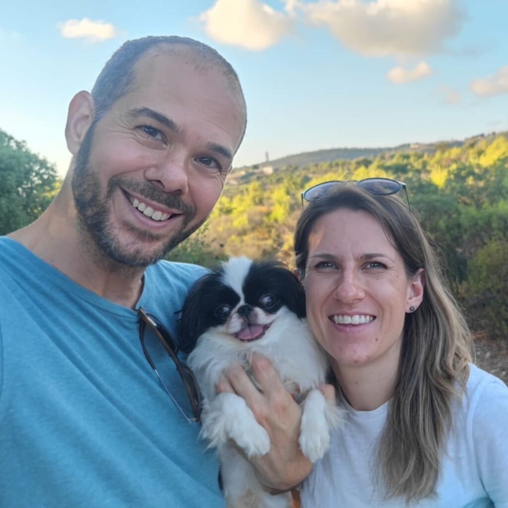
In 2019, David and Desiree relocated to Israel from Canada. Shortly afterward, the global pandemic hit, compelling them to adjust their lives. They combine their love for Jehovah, history, and entrepreneurship to create a unique business venture.
In this post, we’re excited to discuss one of their standout creations: the Digital Field Bible Map of Ancient Israel. This tool is an invaluable resource for Bible students around the globe. It does more than just display geographical locations; it really brings the Bible to life by highlighting roadways, ancient landmarks, and unique cultural details. Today, we’ll take a dive into their creative journey, explore the challenges they faced, and share their hopes for the future!
But before we dive in, here’s a special treat:
David and Desiree are offering my readers $2 off their map!
Use the code PSALM348 at checkout to get this incredible resource. Don’t miss out!

Personal Background
Q. Where does your business name, “Drink Offering,” come from, and what inspired it?
We felt Drink Offering was a unique name that connected every aspect of our programs. It is mentioned in the Hebrew and Greek scriptures it was a symbol of sacrifice, hospitality and giving of yourself for others. It is also cultural because you can’t visit the Middle East without a local offering you a drink of something. Also, some of the best viewpoints in Israel, and the best food, are at the family owned wineries, which we incorporate into our in-person tours.
Q. What sparked your passion for history, and how has it influenced your work?
David: I have always loved history as a topic. I love puzzles, and history is still the greatest unsolved puzzle. But each time you can make, or help others make, a match between secular history and the Bible, it is a wonderful feeling.
The Map’s Creation
Q. What motivated you to create the Field Bible Map, and how long did the process take?
The process began simply out of our own need for a comprehensive map. With our work, research and study style, maps like See the Good Land or Carta Bible Atlas just weren’t detailed enough. They are also not very up-to-date. See the Good Land, for example, was published in 2003, with most of the research being compiled in the late 1990’s. So when we are touring people through sites like Khirbet Qeiyafa in the Elah Valley, the site is unlisted because it simply wasn’t discovered and excavated until after 2008. The last 20 years have produced a wealth of changes to our archaeological understanding, so we needed a map to reflect that better. The data collection has been a product of about 15 years of research. Making the map itself was about 3 months.
Q. What makes your map different from other resources?
The big thing is it lists all the known cities and villages, even if we don’t know the name or Biblical match. It helps the user to see the population centers and, for example, how many cities around Mount Carmel would have seen the fire descend from heaven during Elijah’s fire test. Another aspect is we include things like known temple sites and resources. This can sometimes help with understanding why certain areas were fought over so viciously.
Q. How do you ensure the historical and biblical accuracy of your content?
That’s always the challenge, as archaeology needs to be interpreted and traditions often cloud judgement. Our focus was on consensus research from the last 5-10 years. In areas where there are debates on a location identification, we defaulted to the Bible’s description of the location. Living in Israel, we have the advantage of taking an afternoon to see the area ourselves, with Bible in hand, to determine if it is a match.
Use code PSALM348 at checkout for $2 off their digital map. Get it here.
Challenges and Research
Q. What challenges did you encounter when creating the map, and how did you overcome them?
The Map covers the Southern Levant, which is a French term for the areas of modern Israel, Jordan, Lebanon and Syria. The challenge is that there has been little archaeology done in Syria, Lebanon, and the Upper Sinai in the last 20 years, due to the political climate. The archaeological surveys therefore are difficult to find, usually in French or German, and have a lot of incomplete data. The West Bank (Palestine) has similar challenges. Due to the politics, archaeologists typically can’t label something as “Israelite Period”, or the government could revoke their license to dig. So we need to filter through the politics and read between the lines on the findings. The general idea is that as more information comes to light, we can issue a revision, every year or two, for everyone who purchased a map.
The map features intricate details like roadways, sea routes and more. How did you go about researching and mapping these features?
The roadways are actually the easiest to figure out because most modern roads follow the ancient ones. Villages are always built near roads, and the archaeological surveys include “pottery assemblages” that were found. This basically means where pottery fell off the wagon. Combine that with the topography and the roadways just start to appear on their own. We are also working on a First Century map, which is much easier because the Romans used road markers that we can find today. The sea routes are more of a challenge and require deeper research. So for example, in Tyre they find pottery and metal ingots from places like Sardinia, Myceanae, Crete and other places, so it helps establish an idea of the trade network. An interesting one is the recent discovery of wine flavoured with vanilla in Jerusalem. Because vanilla is only found in Madagascar or the Americas, we can safely assume that from the Red Sea, the Israelites in Solomon’s lifetime sailed to Madagascar… which could also be where he got the monkeys.
Usage
Q. How do you see the map enhancing personal Bible study?
There is a reason that every Bible has maps: they help with visualizing distances and locations as well as showing what we know and what we don’t with locations and areas of the Bible. That said, we also joke that sometimes a map also just looks nice on an office wall.
Q. If someone purchases the map, what study project would you recommend starting with?
Visualizing the battles of the Judges, or the travels of Elijah or David, are a lot easier with a comprehensive map. Another one I always like is that Samuel’s sons were judges in BeerSheva, and everyone complained it was not sufficient for the nation. Take a look at BeerSheva on the map and then where the population centers of the tribes are, and you’ll understand the amount of travel that would have been required to have your judicial case heard.
Looking Ahead
Q. What are your hopes for the future of the Field Bible Map?
This map is just the foundation stone of a larger atlas to come, where specific battles and travels will be mapped out. We are currently compiling all the data for a map of the same region for the periods of about 150BCE-70CE, what we call the Hasmonean and Early Roman Period. Once that is done, we will have what we need to quickly produce maps outlining specific events, battles and travels.
Q. Are there any new products or ventures you’re currently working on?
Outside of the map, we have our in person tours and virtual program, Taste and See TV. All the research gets reformatted for those programs. When it’s all put together, we have enough to support ourselves and continue our more important work in Israel.
David and Desiree’s love for Jehovah and their passion for history shine through every detail of their work, making their contributions both meaningful and inspiring. Whether you’re looking to enhance your personal study or explore biblical history, their projects are sure to inspire and educate.
Follow Their Journey: for more updates on their inspiring work and to see how the Field Bible Map and other resources can enrich your study, visit their Instagram or website.

Use the code PSALM348 at checkout for $2 off.
Greetings! I am Alla Lily, and I have been on a quest to make my personal study more enjoyable and effective. I hope my study tools can help you transform your spiritual study routine and boost retention and comprehension of the material.